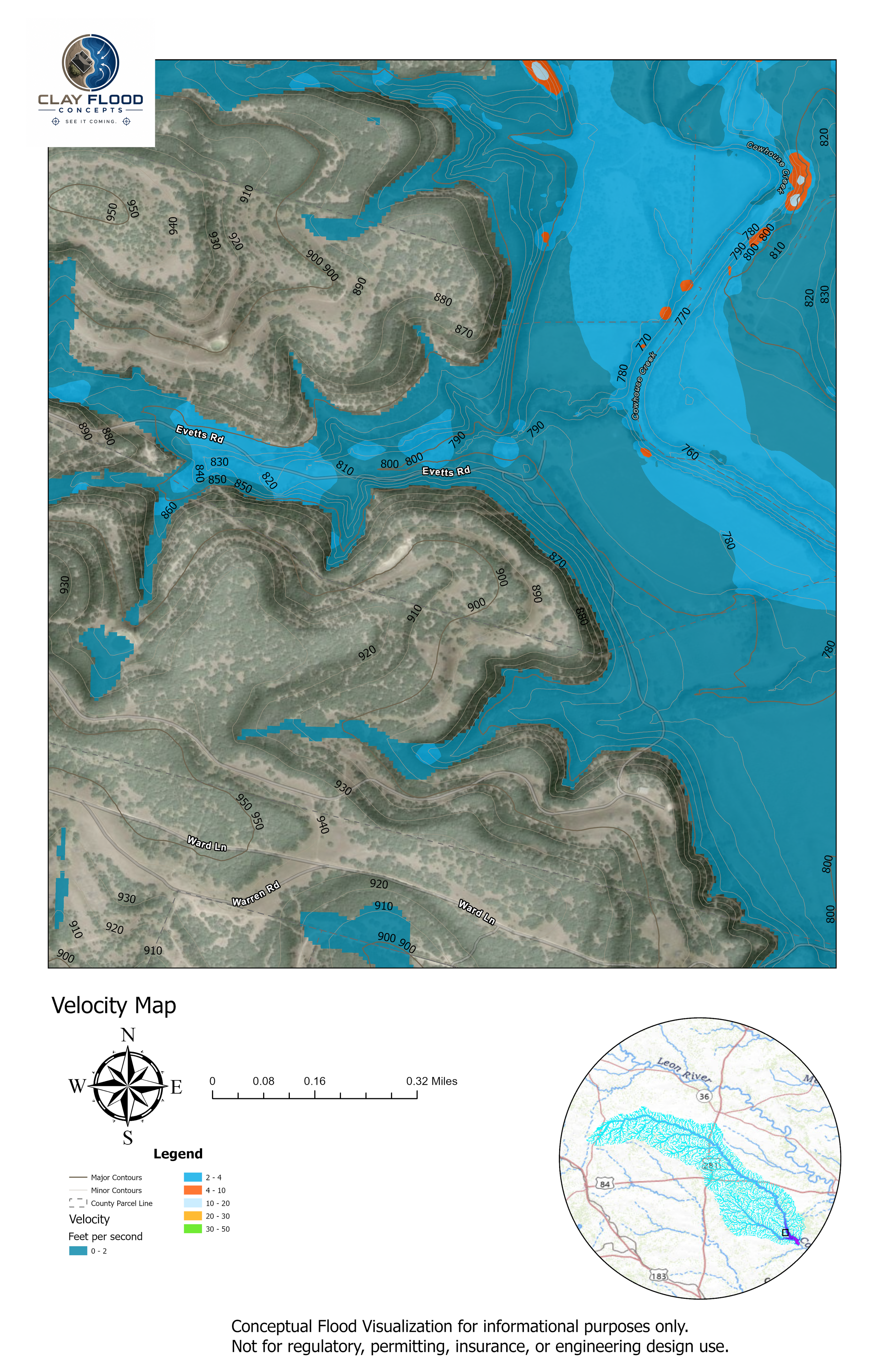
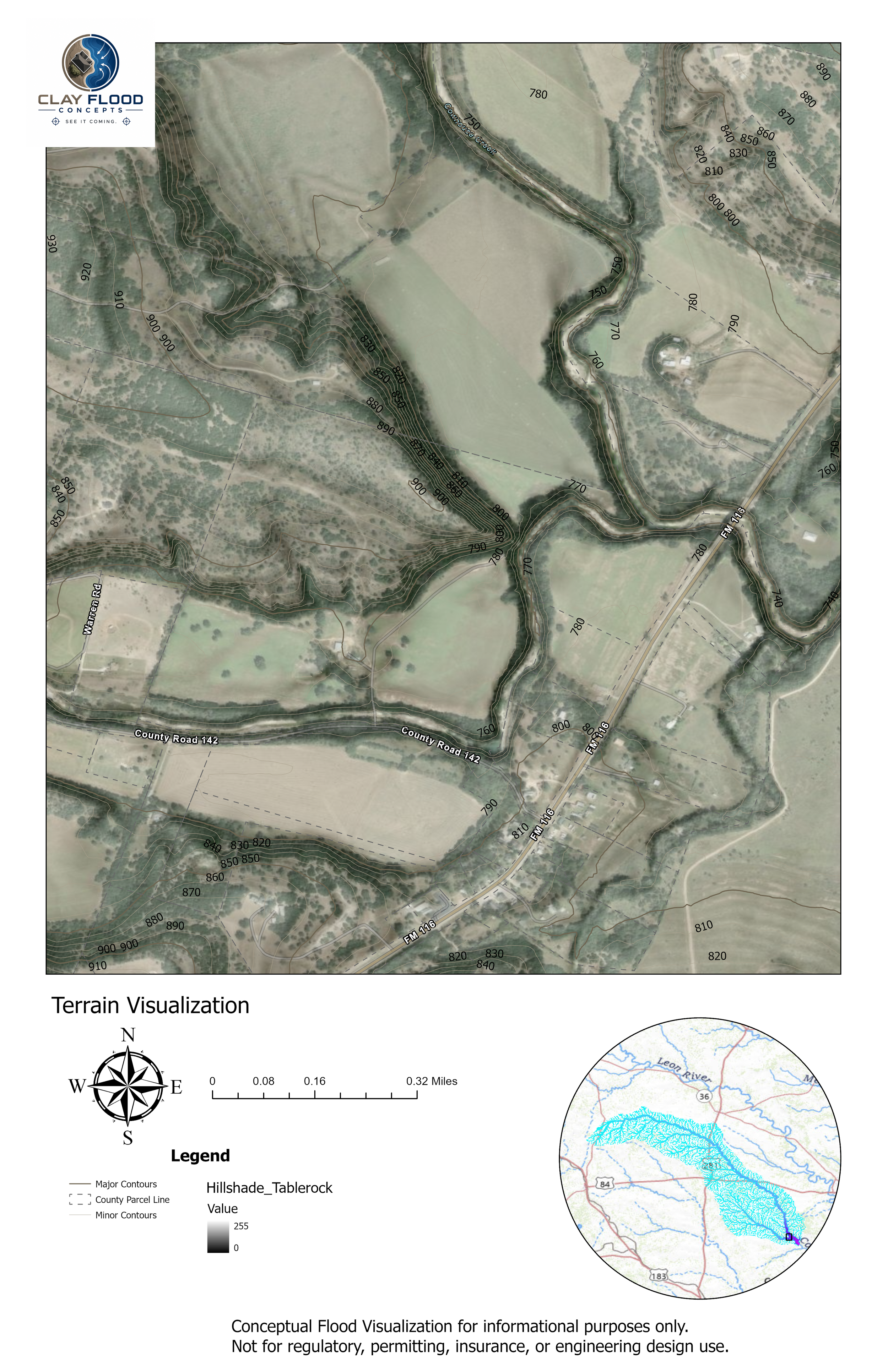
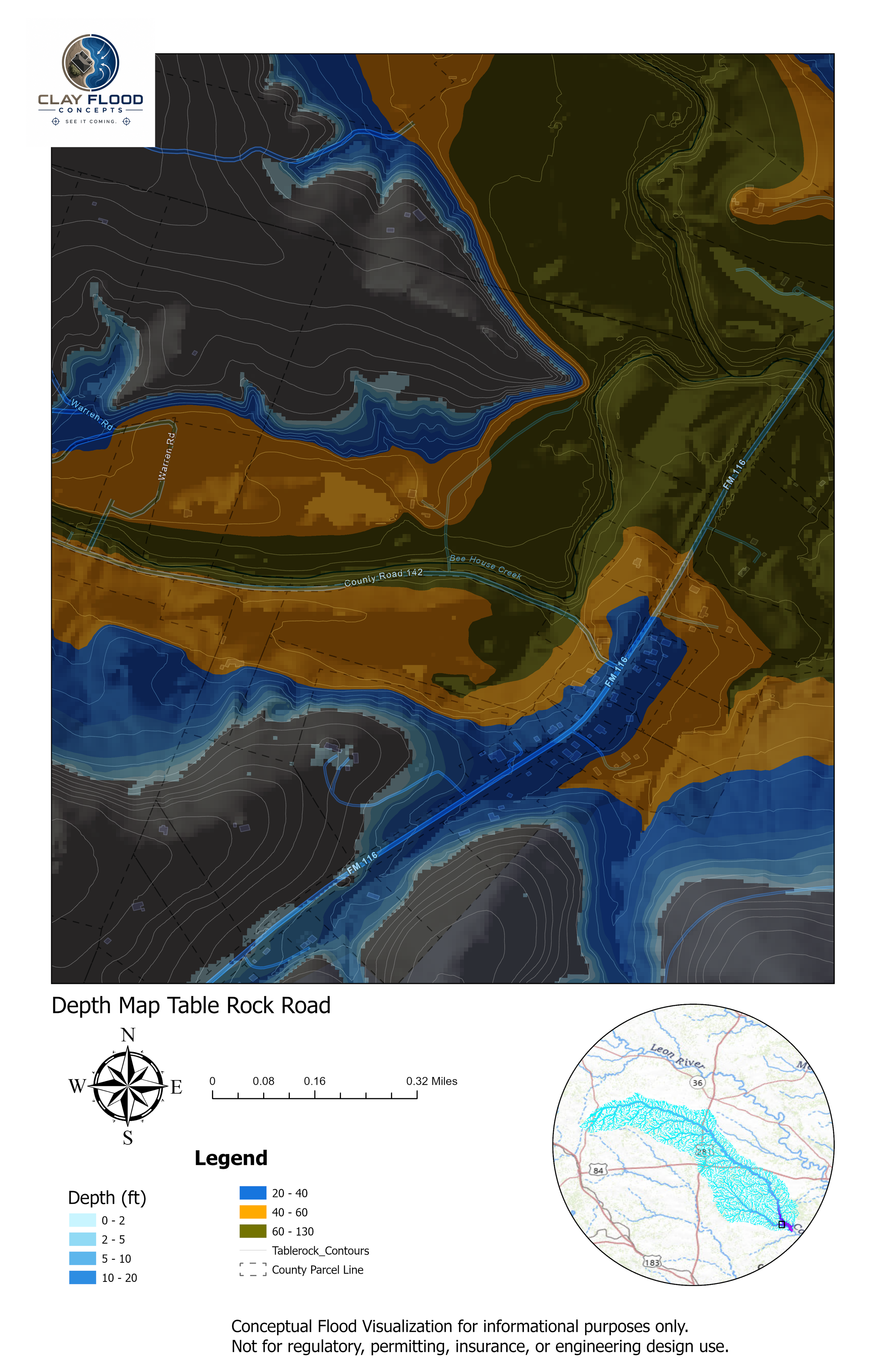
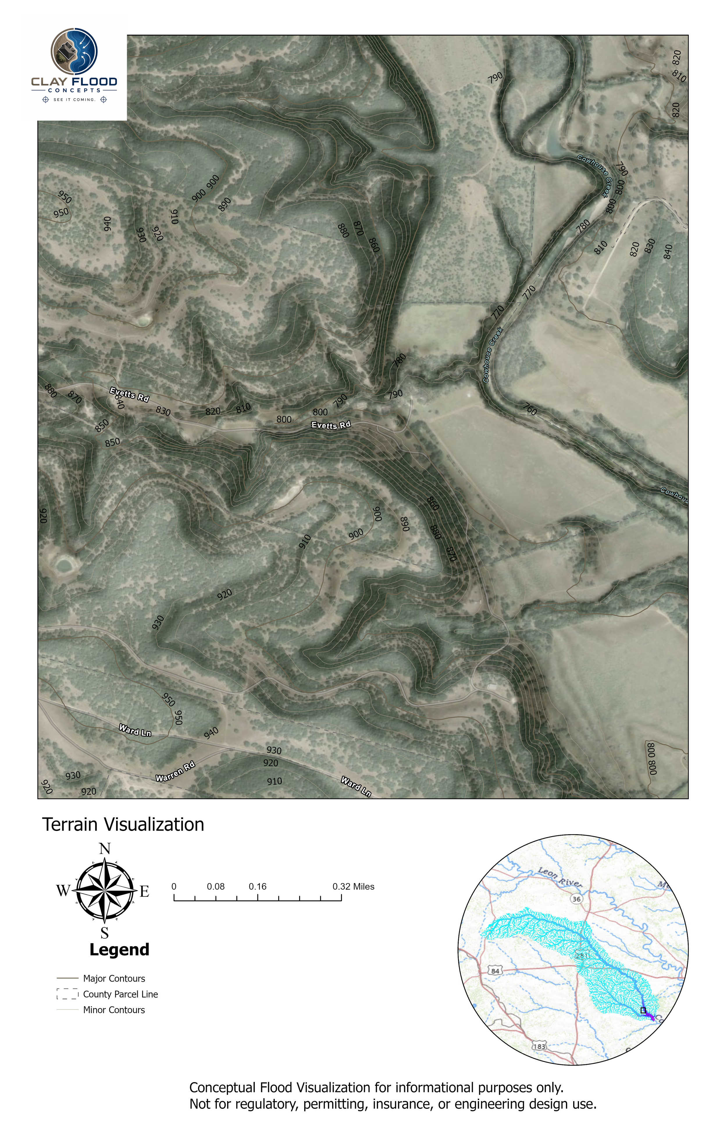
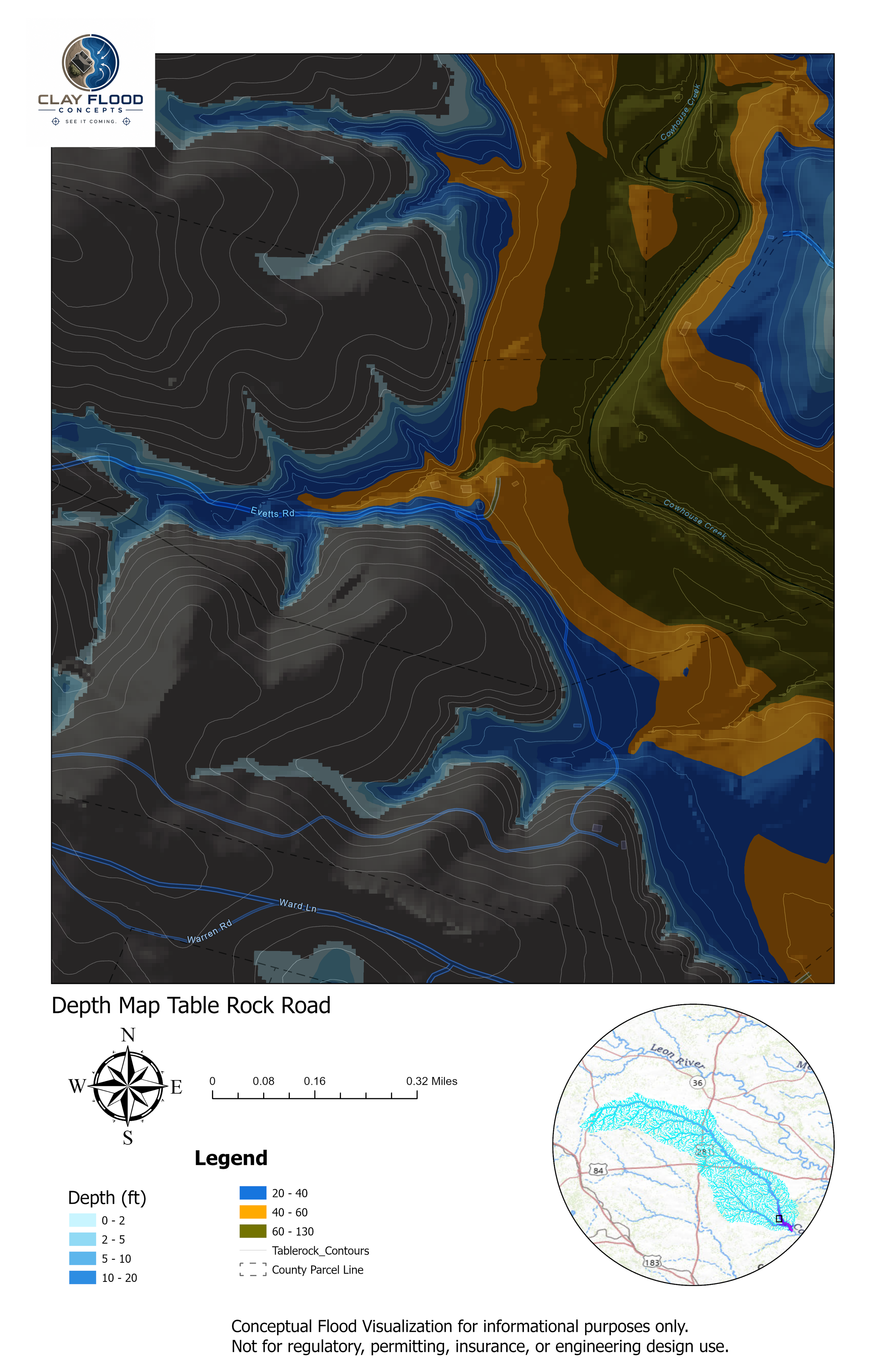
The concept maps we offer are basic property topography and aerial imagery, extreme rainfall event depth map, velocity maps, animations, and 3D visuals
-
Clay Flood Concepts was created after our family survived the catastrophic July 4 Guadalupe River flood, where we lost our son, Clay.
The experience changed the way I think about flood risk forever.
As a civil engineer with more than 20 years of experience, I realized most people never truly visualize what extreme floodwater can do until it is too late.
These visualizations exist to help property owners better understand potential flood behavior on their own land before disaster strikes.
-
We use terrain data, hydraulic modeling, and flood visualization tools to create conceptual representations of extreme flood scenarios on private property.
These visualizations are designed to help property owners better understand:
• potential flood depth
• water movement and velocity
• isolated access routes
• areas of elevated hazardOur goal is simple: make flood risk easier to see and easier to understand.
These products are conceptual visualizations intended for informational purposes only and are not regulatory flood studies, engineering design documents, or emergency warning systems.
Baseline Purchase - Terrain Map and Depth - Click to Enlarge
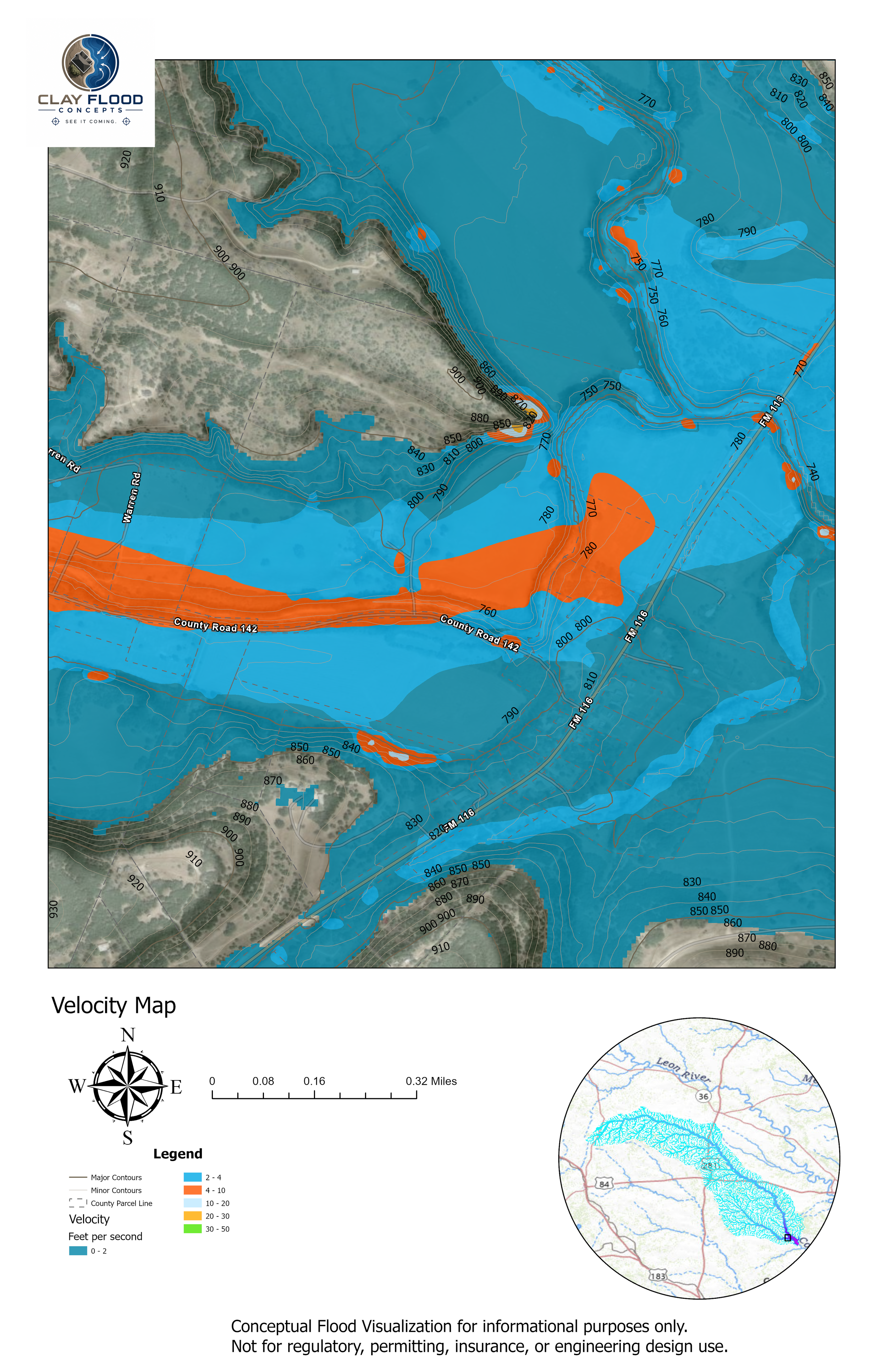
Add-on - Velocity